Renovation budgets rarely get blown up by the finishes everyone can see. The real damage usually starts earlier – when drawings do not match site conditions, hidden offsets get missed, and teams make decisions from partial measurements. That is exactly why use LiDAR for renovation has become a serious question for owners, architects, contractors, and facility teams managing complex spaces.
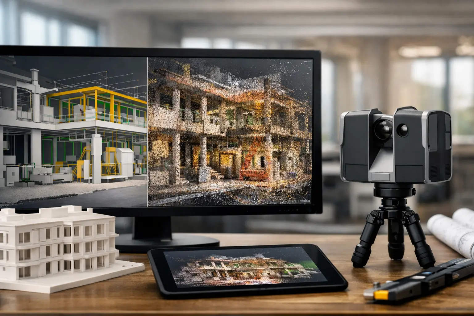
LiDAR gives renovation teams a high-accuracy digital record of existing conditions before design work moves too far downstream. Instead of relying on tape measures, fragmented legacy drawings, or multiple return visits, teams work from a detailed 3D capture of the space as it actually exists. That changes the quality of planning, coordination, and decision-making from the start.
Why use LiDAR for renovation planning
At renovation stage, the biggest challenge is not imagining the future. It is understanding the present with enough certainty to avoid expensive surprises. Existing buildings often carry years of undocumented changes – shifted walls, added services, uneven floors, nonstandard ceiling heights, or mechanical runs that were never updated in drawings.
LiDAR addresses this by capturing dense spatial data quickly and with a level of precision that traditional site measurement methods struggle to match at scale. For renovation teams, that means fewer assumptions. When the design model reflects actual site geometry, decisions around demolition scope, structural coordination, MEP routing, fit-out planning, and cost estimation become more reliable.
This matters even more in occupied properties, heritage assets, industrial sites, hotels, retail environments, and large commercial buildings where shutting down operations for repeated manual measurement is impractical. A single scanning exercise can create a reusable digital foundation for multiple project stakeholders.
Accuracy is not just a technical benefit
Accuracy sounds like an engineering point, but in renovation it is a commercial one.
When site data is wrong, every downstream activity absorbs the cost. Designers spend more time validating dimensions. Contractors raise more RFIs. Fabrication teams adjust components on site. Project managers deal with delays and rework. Owners absorb budget pressure and timeline drift.
LiDAR reduces that chain reaction by establishing a dependable as-built baseline. In Scan-to-BIM workflows, the point cloud can be converted into structured models and documentation that support design development, coordination, approvals, and handover. Instead of debating what is on site, teams can focus on what should happen next.
That does not mean LiDAR eliminates every renovation risk. Hidden conditions behind walls, above ceilings, or under floors can still appear once work starts. But it significantly reduces the number of avoidable errors caused by incomplete existing-condition surveys.
Faster capture, better decisions
One reason why use LiDAR for renovation is becoming more common across AEC and facility-led projects is speed. Manual site measurement is time-intensive, especially for large, irregular, or operational environments. It also depends heavily on individual note-taking and field interpretation.
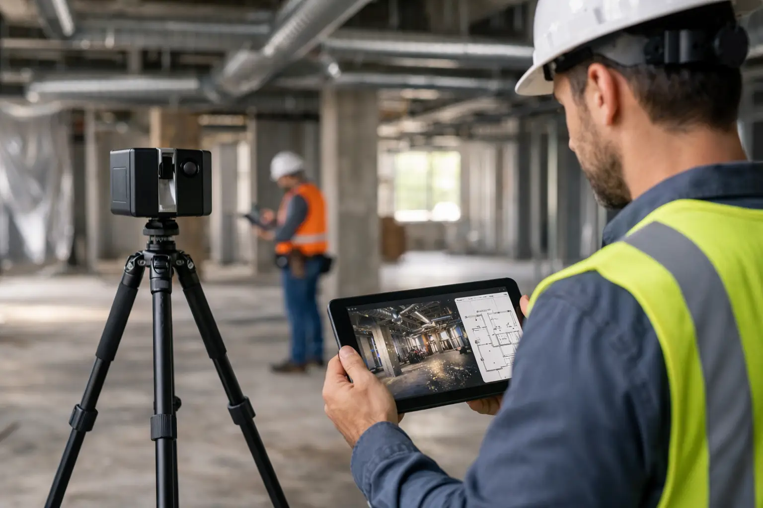
LiDAR compresses that process. A space can be captured far faster than it can be measured by hand, particularly where there are multiple rooms, varying elevations, complex services, or access constraints. More importantly, the result is not just a stack of field notes. It is a digital spatial dataset that teams can revisit without constantly returning to site.
That has practical value during renovation planning. If a stakeholder asks for a dimension after the survey, the answer is often already available within the captured dataset. If the project expands in scope, the same scan can support additional design work. If remote stakeholders need visibility, the spatial record can be used alongside digital twin and visualization workflows to support review without another physical visit.
Renovation risk drops when teams see the same reality
Renovation projects often fail at the handoff points. The survey team sees one thing, the designer interprets another, and the contractor encounters something else on site. LiDAR helps align those viewpoints because everyone works from the same source of truth.
That shared visibility becomes especially valuable in projects involving consultants, landlords, tenants, operators, and approval stakeholders. A detailed digital capture supports clearer communication around existing conditions, proposed interventions, and scope boundaries. In commercial environments, that can accelerate decision-making because fewer conversations are spent resolving uncertainty.
For owners and developers, this is where LiDAR starts to move beyond a technical service and becomes a management tool. Better site intelligence supports better procurement, better phasing, and better expectation setting across the project team.
Where LiDAR adds the most value in renovation
Not every renovation requires the same level of capture. A small cosmetic refresh in a simple unit may not need advanced scanning. But as project complexity increases, LiDAR becomes far more compelling.
It is particularly useful when the building has limited or outdated documentation, when geometry is irregular, when multiple trades need tight coordination, or when the cost of rework is high. It also performs well in live environments where speed matters and site disruption needs to be minimized.
In hospitality renovations, for example, accurate spatial capture helps teams plan upgrades across guest rooms, lobbies, back-of-house areas, and MEP zones while protecting operational continuity. In retail and commercial fit-outs, it supports precise planning for millwork, signage, lighting, and services integration. In industrial and facility environments, it gives asset managers a clearer basis for retrofit planning and ongoing documentation.
For older buildings, LiDAR is often one of the most efficient ways to establish current conditions before design starts. Legacy drawings may exist, but they are not always reliable enough for renovation-grade decisions.
Why use LiDAR for renovation instead of manual surveys alone
Manual surveys still have a place. They are useful for quick checks, small areas, and validation tasks. But on most renovation projects, relying on manual measurement alone creates avoidable exposure.
The limitation is not just speed. It is data completeness. Manual methods capture selected dimensions. LiDAR captures the space more holistically. That difference matters when project requirements evolve, which they often do. A dimension that seemed irrelevant during the first visit may become critical later during design development or construction coordination.
There is also a consistency advantage. Manual surveys depend heavily on field skill, notation quality, and revisit availability. LiDAR creates a more durable record that can support architects, engineers, quantity teams, BIM modelers, and operators from the same capture event.
The trade-off, of course, is that LiDAR requires the right scanning methodology, data processing, and interpretation. Raw point clouds are valuable, but the business outcome depends on how well that data is turned into usable deliverables such as as-built drawings, BIM models, coordination files, or digital twins. The scanning itself is only one part of the workflow.
LiDAR supports design, construction, and operations
A strong renovation survey should not lose value after design kickoff. One of LiDAR’s biggest advantages is that the same dataset can support multiple phases of the asset lifecycle.
During design, it improves confidence in existing conditions and allows more accurate modeling. During construction, it helps teams coordinate with real site geometry and reduce clashes. After completion, it can contribute to updated as-built records and a stronger documentation base for future maintenance or expansion.
This is where companies like Novo Reperio create more strategic value. When LiDAR capture connects with Scan-to-BIM, digital twin environments, and broader spatial visualization workflows, the output becomes more than a survey file. It becomes a working digital asset that supports planning, stakeholder communication, and long-term property management.
For commercial decision-makers, that matters because renovation is rarely a one-time event. Buildings continue to evolve. The more usable your spatial data is today, the better positioned you are for the next fit-out, upgrade, lease turnover, or facility change.
The ROI question
The cost question always comes up, and fairly so. LiDAR is not the cheapest way to document a site if you only compare upfront survey fees. But renovation decisions should be judged by total project impact, not isolated line items.
If better capture prevents redesign, reduces rework, shortens site visits, improves stakeholder alignment, or avoids fabrication errors, the return can be significant. On larger projects, those savings are often far greater than the survey cost itself. On smaller projects, the value depends on complexity, tolerance requirements, and the consequences of getting existing conditions wrong.
That is the real answer to why use LiDAR for renovation: not because it is newer, but because it reduces uncertainty where uncertainty is expensive.
When renovation teams start with reliable spatial intelligence, they plan with more confidence, coordinate with fewer assumptions, and make decisions faster. If your project involves complex existing conditions, multiple stakeholders, or limited tolerance for error, LiDAR is not an added extra. It is often the step that keeps the rest of the project moving in the right direction.