A renovation budget can unravel quickly when the existing building is wrong on paper. Ceiling heights differ from old drawings, services were rerouted years ago, and structural elements sit a few inches away from where the team expected them to be. That is where as built documentation services move from nice-to-have to operational necessity. They give owners, developers, consultants, and facility teams a verified record of what is actually on site, not what was intended years earlier.
For commercial projects, accuracy is not just a technical concern. It affects design coordination, contractor pricing, compliance reviews, maintenance planning, and the speed of decision-making. If your documentation is incomplete, every downstream workflow becomes slower, riskier, and more expensive.
What as built documentation services actually deliver
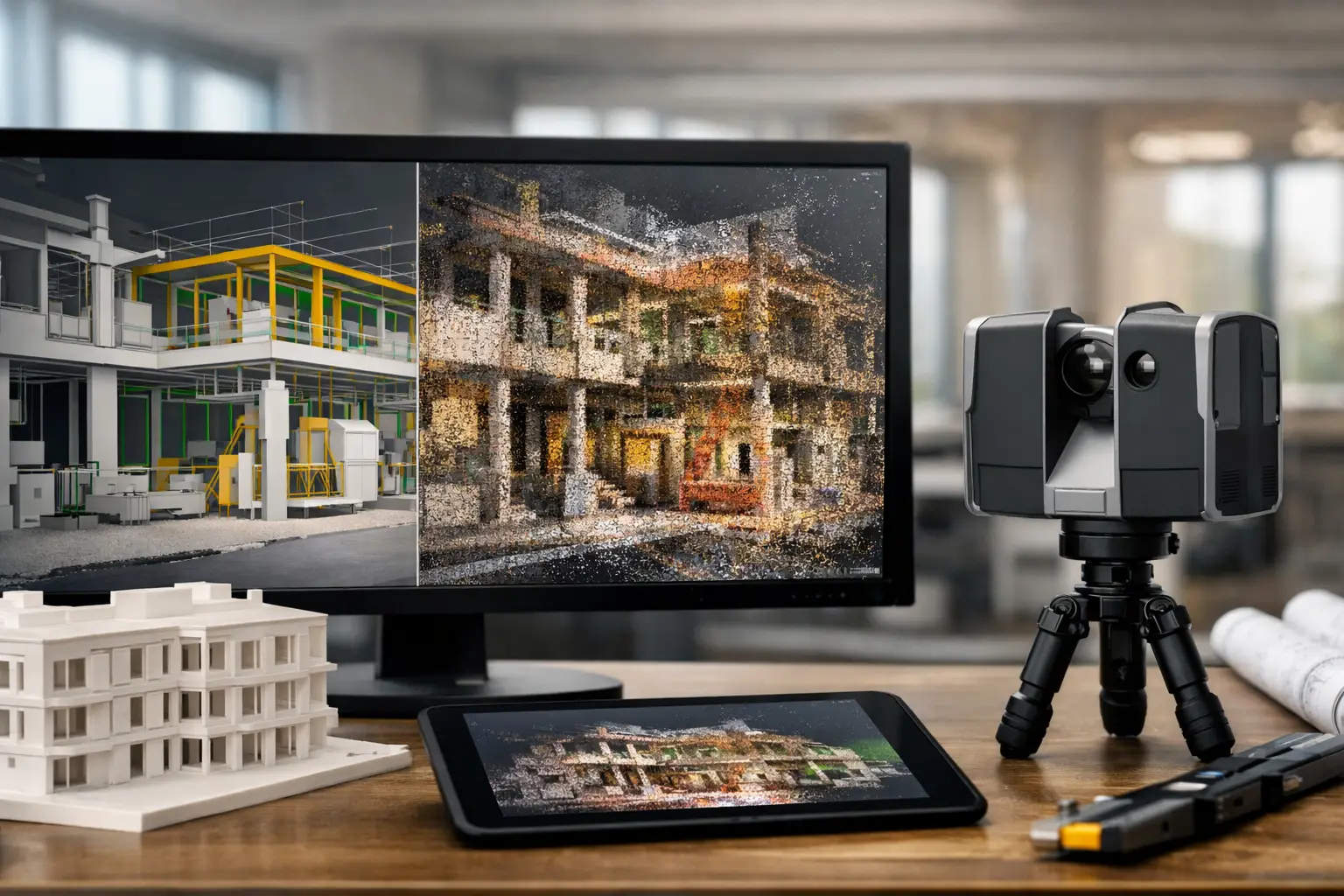
At a basic level, as built documentation services capture the current physical condition of a space or asset and convert it into usable records. Those records may include measured floor plans, reflected ceiling plans, elevations, sections, site layouts, 3D point clouds, BIM models, and equipment location data.
The exact deliverable depends on the business need. A retail chain planning rollouts may only need dependable measured drawings for fit-out standardization. A hospital or industrial facility may require a dense, survey-grade spatial dataset that supports asset planning, MEP coordination, and long-term facility management. A property owner preparing for renovation may need a Scan-to-BIM model that gives architects and engineers a reliable base for design.
This is why the best documentation approach is never one-size-fits-all. The right scope depends on how the data will be used after capture.
Why outdated drawings create expensive problems
Many buildings have a documentation gap. Original construction drawings exist, but they no longer match reality. Over time, spaces are subdivided, services are relocated, facades are modified, and equipment is replaced without a full update to the record set.
That gap creates friction in almost every project stage. Design teams spend extra time validating site conditions. Contractors add contingencies because dimensions are uncertain. Facility managers lose time locating services above ceilings or behind walls. Owners make decisions with partial information.
In sectors such as hospitality, commercial real estate, industrial, and mixed-use developments, these issues are multiplied by scale. A small discrepancy repeated across multiple floors or buildings can distort budgets, schedules, and procurement. Accurate documentation reduces rework because teams start with reality, not assumption.
How modern capture methods improve documentation quality
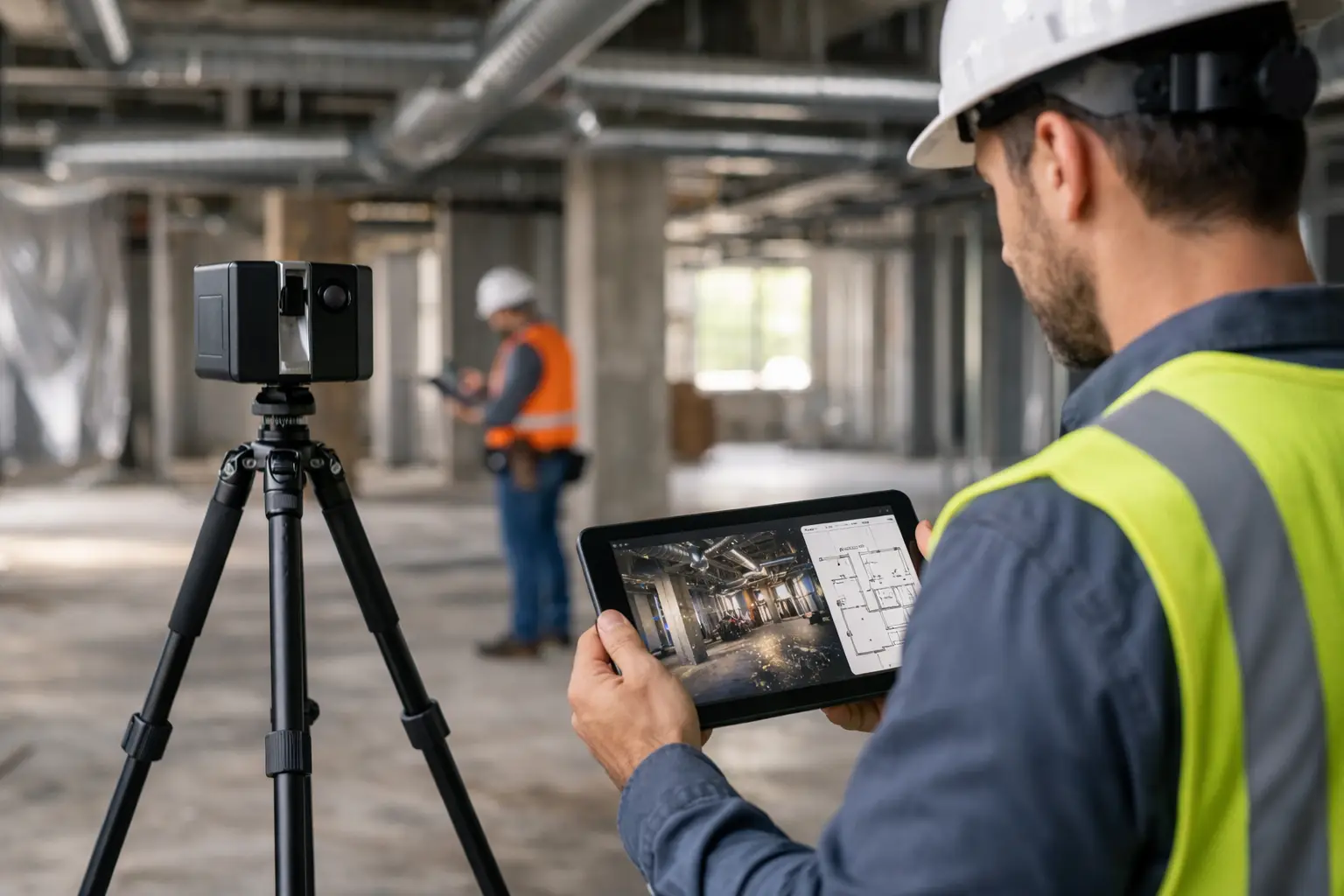
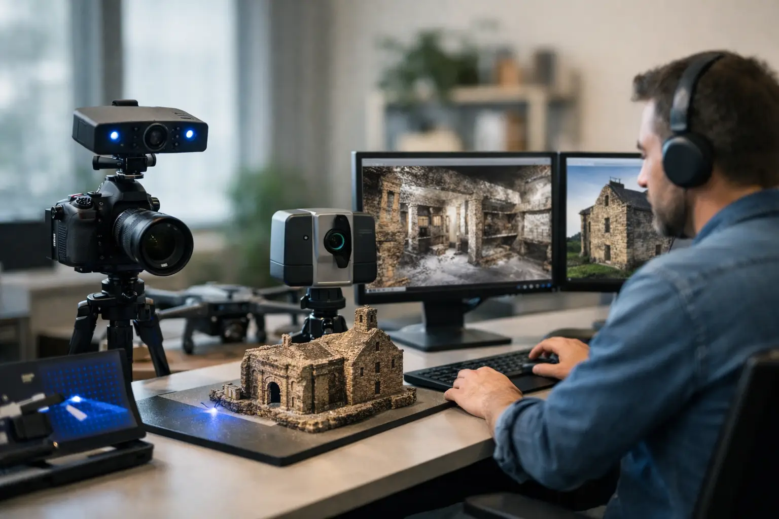
Traditional hand measurement still has a place for small and simple spaces, but it becomes inefficient when sites are large, complex, active, or highly serviced. Modern as built documentation services typically rely on LiDAR scanning, 3D mapping, and image-based capture to document spaces faster and with far greater consistency.
LiDAR scanning records millions of spatial data points across a site. That point cloud becomes a measurable digital reference that teams can revisit long after the fieldwork is complete. Instead of relying on scattered notes and selected dimensions, consultants can interrogate the captured environment in detail.
This changes the quality of downstream work. Architects can model from accurate geometry. Engineers can review clearances and service routes. Owners can preserve a digital record before renovation, handover, insurance review, or asset transfer.
The practical benefit is not just precision. It is reduced uncertainty. When teams have a dependable digital baseline, they spend less time checking, revising, and disputing what exists on site.
As built documentation services for different business cases
Renovation and retrofit planning
Renovation projects depend on understanding constraints early. Slab levels, beam positions, riser locations, facade geometry, and existing MEP systems all shape design feasibility. Accurate documentation helps consultants design within real conditions and identify clashes before procurement or construction.
For adaptive reuse projects, this becomes even more valuable. Older buildings often contain undocumented changes that only surface once demolition starts. Capturing the space in detail upfront lowers the chance of costly surprises.
Facility management and operations
For operating buildings, the value goes beyond capital projects. Verified drawings and models support maintenance planning, space audits, asset tracking, and team coordination. If a facility team can quickly reference plant rooms, ceiling voids, service pathways, or room configurations, response times improve.
In complex properties such as hotels, campuses, factories, and logistics facilities, a digital spatial record also supports training and remote collaboration. Teams do not need to rely only on site visits to understand the environment.
Property transactions and portfolio management
Developers, asset managers, and investors often manage multiple properties with inconsistent documentation standards. As built capture creates a more dependable baseline across the portfolio. That helps with planning upgrades, evaluating leasing changes, and reducing uncertainty during due diligence.
Where timelines matter, especially in active commercial markets across Southeast Asia, faster access to accurate building information can support quicker internal approvals and better consultant coordination.
What to expect from the workflow
A strong provider will begin by defining the business outcome, not just the site size. The question is not simply how many square feet need to be scanned. It is whether the output will support design development, FM integration, condition records, marketing visualization, or compliance review.
From there, capture planning should account for access conditions, operating hours, safety requirements, level of detail, and the types of spaces involved. A live hotel, manufacturing site, or retail environment needs a different field strategy than an empty shell building.
Once scanning or spatial capture is complete, the raw data is processed into agreed deliverables. That may include CAD drawings, Revit models, point clouds, annotated layouts, or integrated digital twin environments. Quality control matters here. Even advanced capture methods can produce poor outcomes if modeling standards, naming logic, or coordination protocols are weak.
The strongest documentation workflows do more than hand over files. They structure information in a way that other teams can actually use.
Choosing the right level of detail
Not every project needs a highly detailed BIM model. In fact, overscoping is a common mistake. If your immediate goal is lease planning or basic fit-out design, a precise 2D package may be enough. If you are coordinating structural, architectural, and MEP upgrades, a richer model becomes more valuable.
This is where commercial clarity matters. Better documentation should improve project outcomes, not just increase file complexity. A good partner will help align capture method, modeling effort, and final deliverables with the actual decision that needs to be made.
There is always a trade-off between speed, depth, and budget. Higher detail supports more use cases, but only if those use cases are real. The smartest investment is usually the one that avoids wasted scope while preserving future flexibility.
Why integration matters more than raw data
A point cloud on its own is useful, but value increases when documentation fits into broader workflows. That may mean Scan-to-BIM for architects and engineers, digital twin environments for remote stakeholder review, or structured spatial data that supports operational planning.
This integrated approach is where firms like Novo Reperio can create stronger business value. The capture process is not treated as an isolated survey exercise. It becomes part of a wider digital strategy for visualizing, managing, and improving physical spaces.
For clients balancing marketing, asset planning, and operations, that joined-up model matters. One capture event can potentially support design, facilities, stakeholder communication, and future digital experiences if the workflow is planned correctly from the start.
How to evaluate a provider
The best provider is rarely the one promising the cheapest scan. What matters is whether they understand both spatial accuracy and commercial application. A technically capable team should be able to explain capture tolerances, modeling standards, and deliverable formats. A commercially capable team should also be able to explain how those outputs reduce risk, improve speed, or support revenue decisions.
Ask how they manage active sites, how they define levels of detail, and how they verify final outputs. Ask whether they can support different end uses, from design coordination to digital twin deployment. If the conversation stays only at the level of equipment, you are probably not speaking to a strategic partner.
The real test is simple: can they translate complex site conditions into documentation your teams can trust and use immediately?
Accurate building records do not just make projects cleaner. They help businesses move with more confidence when time, cost, and coordination are all under pressure. If your space is central to revenue, operations, or future development, the right documentation is not paperwork. It is infrastructure for better decisions.