A renovation budget can start slipping long before the first wall comes down. Usually, the problem is not design intent. It is missing site truth. LiDAR scanning for buildings changes that by capturing accurate spatial data at the start, so architects, engineers, owners, and operators are not making decisions from outdated drawings, partial surveys, or guesswork.
For commercial properties, hotels, industrial sites, mixed-use developments, and heritage assets, that accuracy has a direct business effect. Better data supports faster approvals, cleaner coordination, fewer site surprises, and more confident remote decision-making. It also creates a digital foundation that can be reused across marketing, operations, maintenance, and future redevelopment.
What LiDAR scanning for buildings actually delivers
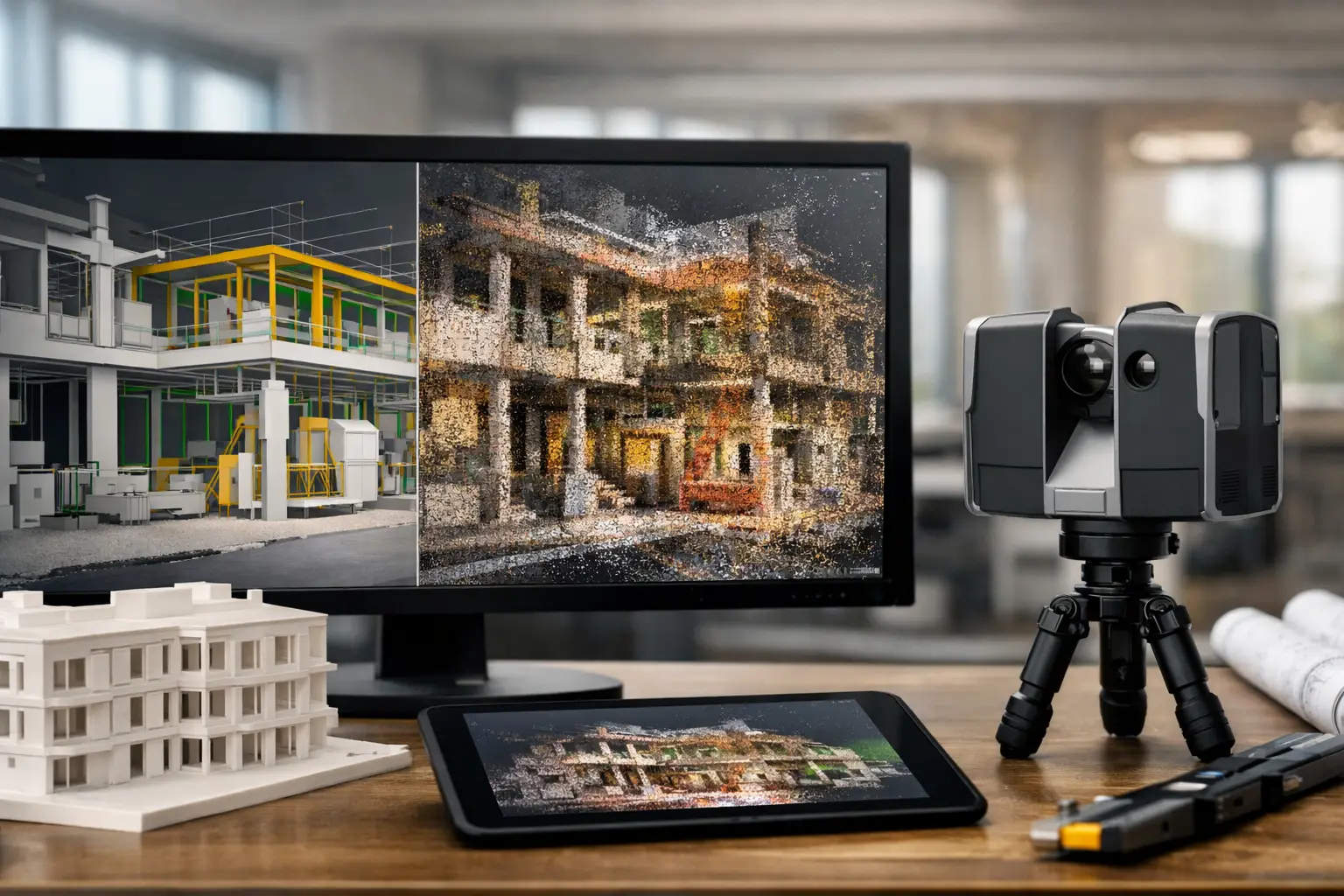
LiDAR uses laser pulses to measure distances and generate dense 3D point clouds of a physical environment. In practical terms, it records how a building really exists, not how it was intended to be built years ago and not how it appears in a limited set of photos.
That distinction matters. Many commercial properties have undocumented changes, hidden complexity above ceilings, structural irregularities, or service routes that do not match legacy plans. A high-quality scan captures geometry with far greater completeness than manual measurements alone, especially across large floorplates, plant rooms, facades, stair cores, and hard-to-access areas.
The output is not just a visual model. Depending on the project, it can support as-built documentation, Scan-to-BIM workflows, clash detection, area verification, digital twin creation, and condition recording. For owners and project teams, the value is not the scan itself. The value is having dependable building intelligence that can be used across multiple decisions.
Why building owners and project teams are investing now
The strongest case for LiDAR is rarely technical curiosity. It is usually cost control and decision speed.
When teams rely on fragmented building records, they spend more time verifying dimensions, revising layouts, and resolving conflicts on site. That slows design development and increases rework risk. On active commercial sites, it also disrupts operations because repeat visits, manual checks, and delayed coordination extend the project timeline.
LiDAR scanning for buildings helps reduce those issues by creating a shared spatial reference point. Designers can model against actual conditions. Contractors can plan around verified dimensions. Asset managers can document existing layouts for maintenance and future fit-outs. Marketing teams can even use the same captured environment as the basis for digital twins, virtual tours, or visual sales assets.
In markets where stakeholders are often spread across cities or countries, this matters even more. A decision-maker in Singapore reviewing a hotel renovation in Kuala Lumpur or a regional property team assessing a logistics facility in Johor needs more than static photos. They need a reliable digital representation of the asset.
Where LiDAR scanning for buildings creates the most value
Renovation, retrofit, and adaptive reuse
This is where LiDAR often has the fastest return. Existing buildings rarely match archived plans, particularly after years of tenant modifications and MEP changes. Scanning provides accurate geometry before design begins, which reduces redesign cycles and helps consultants coordinate around real constraints.
For adaptive reuse projects, that clarity is even more useful. Converting an office floor into hospitality space, repositioning a retail unit, or upgrading an aging commercial asset requires decisions that depend on precise dimensions, structure, and services.
Scan-to-BIM and as-built documentation
If a building needs Revit or BIM-ready deliverables, LiDAR provides the source data to build from. This gives project teams a dependable basis for as-built models, reflected ceiling plans, elevations, and sectional analysis.
It is important to be realistic here. A point cloud is not the same as a finished BIM model. The quality of the final output depends on scope, level of detail, and the modeling requirements agreed at the start. But when scanning and BIM workflows are aligned properly, the result is a far more efficient route to usable documentation.
Facility management and operations
Operations teams often inherit buildings with poor records. Equipment locations, service clearances, and access routes may not be documented in a way that supports maintenance planning. LiDAR can help create a current spatial record that improves asset tracking, technician coordination, and future capex planning.
For industrial and large commercial environments, this becomes part of a wider digital asset strategy. Instead of treating building data as a one-time project output, organizations can use it as operational infrastructure.
Insurance, restoration, and dispute support
Accurate condition capture has value when claims, damage assessments, or pre-work documentation are involved. A scan can provide a precise record of existing conditions that is easier to reference than scattered photos and handwritten notes. That can improve reporting quality and reduce ambiguity when multiple parties are involved.
What the process looks like on a real project
A successful LiDAR project starts with scope, not equipment. The first question is what the building data needs to achieve. A marketing team creating an interactive digital twin will not need the same deliverables as an architect developing a coordinated BIM model for a phased retrofit.
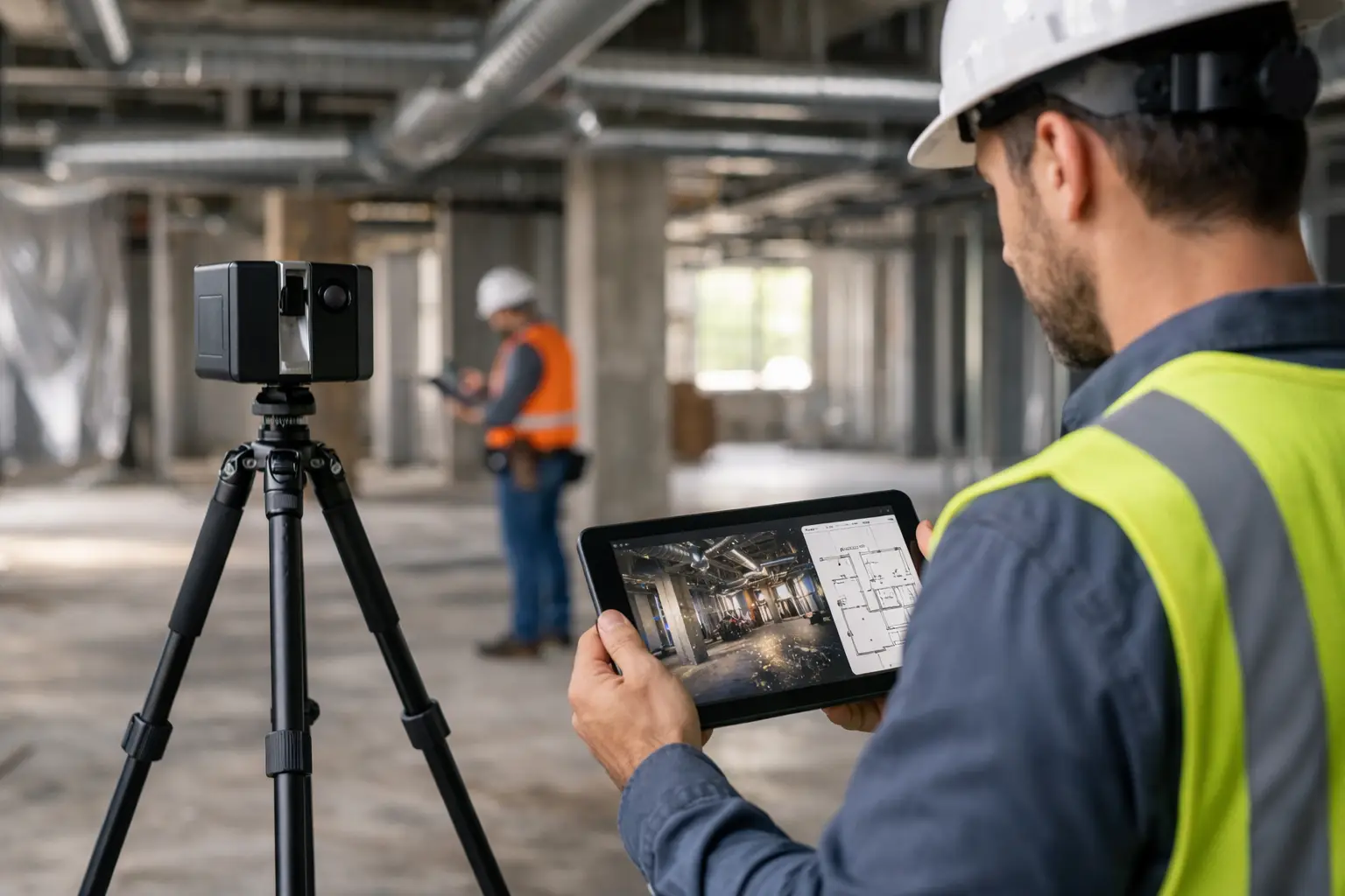
Once scope is clear, the capture plan is built around site conditions, access windows, building size, and required output. Some sites can be scanned quickly with minimal disruption. Others, especially live hotels, retail environments, or industrial facilities, need phased scheduling to avoid operational impact.
After capture, the raw data is registered, cleaned, and processed into usable outputs. That may include point clouds, measured drawings, BIM-ready data, mesh models, or digital environments for stakeholder review. This processing stage is where technical discipline matters. Poor registration or unclear deliverables can reduce the usefulness of an otherwise good survey.
The best outcomes come when scanning is tied directly to the next business use. If the data will feed design, model to design requirements. If it will support leasing, operations, or remote approvals, structure the output so non-technical stakeholders can use it without friction.
Trade-offs decision-makers should understand
LiDAR is powerful, but it is not a cure-all.
First, accuracy depends on method, access, and operator discipline. Complex reflective surfaces, crowded environments, and blocked sightlines can affect capture quality. Second, not every project needs the same level of detail. Over-scanning a simple fit-out can add cost without adding value, while under-scanning a complex plant environment can create expensive gaps later.
There is also a difference between capturing geometry and interpreting it. A point cloud shows what is there. It does not automatically label systems, define maintenance strategy, or replace professional design judgment. That is why experienced providers frame scanning as part of a workflow, not a standalone media product.
Budget is another area where context matters. LiDAR scanning may look like an added line item, but on projects where undocumented conditions create redesign, delay, or site variation orders, the real comparison is against the cost of uncertainty.
Choosing a provider for LiDAR scanning for buildings
The right partner should be able to discuss more than hardware specs. They should understand building use cases, downstream deliverables, and how spatial data will support commercial outcomes.
That means asking practical questions. Do you need point clouds only, or a modeled BIM output? Will the data be used by architects, marketers, facilities teams, or all three? Is the site active, occupied, or operationally sensitive? How will the building information be reused after the immediate project ends?
A capable provider will also be honest about limitations, turnaround time, and what level of detail is realistic for the budget. Precision matters, but so does fit. The best solution is the one that gives your team usable data at the right stage of the asset lifecycle.
For organizations managing portfolios across Southeast Asia, this often means working with a partner who can align capture, modeling, and digital visualization into one implementation path. That is where firms such as Novo Reperio stand apart – not by treating LiDAR as an isolated survey service, but by connecting it to digital twins, Scan-to-BIM, and decision-ready spatial outputs.
The bigger opportunity behind the scan
A building scan should not end up as archived data that nobody reopens. When handled properly, it becomes a reusable digital asset. The same spatial capture can support redevelopment planning today, remote stakeholder review next quarter, and facilities optimization later on.
That is the real shift. LiDAR scanning for buildings is no longer just about measurement. It is about creating a reliable digital version of the built environment that teams can use to market space better, plan work with less risk, and make decisions without waiting for another site visit.
If your building data is incomplete, outdated, or spread across too many files, the next project will expose that weakness. Capturing the space properly now gives you something more valuable than a survey. It gives your team a stronger basis for every decision that follows.