A slab poured 20 millimeters off target can trigger rework, delay follow-on trades, and create an argument nobody wants on site. That is why the question is lidar accurate for construction matters less as a tech debate and more as a cost, risk, and decision-making issue. The short answer is yes – LiDAR can be highly accurate for construction – but only when the workflow, equipment, site conditions, and deliverables match the job.
Is LiDAR accurate for construction in real project conditions?
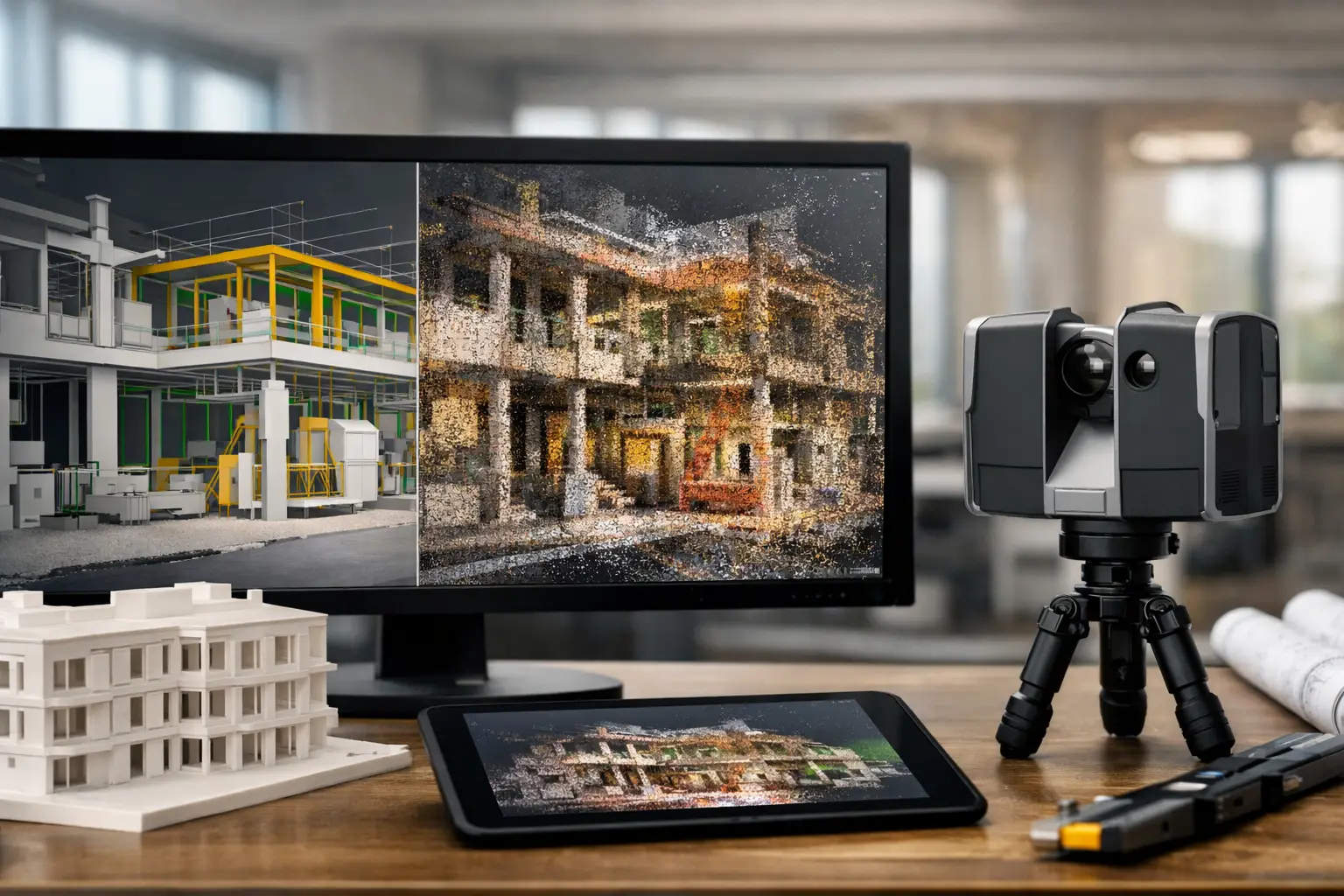
LiDAR is accurate enough for many construction applications, including as-built documentation, progress tracking, clash verification, facade capture, topographic mapping, and Scan-to-BIM workflows. In the right setup, modern terrestrial laser scanners can capture millions of measured points with millimeter-level precision. That gives project teams a far more complete record than manual tape checks or selective spot measurements.
But accuracy in construction is never just about the scanner spec sheet. It depends on how the scan is planned, how control is established, how registration is handled, and what the point cloud is being used for afterward. A highly accurate scan can still produce poor decisions if the data is misaligned, under-scoped, or interpreted without context.
That is the key distinction. LiDAR is not simply accurate by default. It is accurate when the full capture-to-delivery process is managed correctly.
What “accurate” actually means on a construction project
In construction, accuracy has to be tied to use case. A facility manager documenting an existing plant room does not need the same tolerance as a steel contractor checking anchor bolt placement. A developer reviewing overall progress does not need the same data density as a BIM team modeling MEP systems above a congested ceiling.
There are usually three practical layers to think about.
First is measurement accuracy – how close each captured point is to the real-world location. Second is registration accuracy – how well multiple scans are stitched together into one coordinate system. Third is project accuracy – whether the final output supports the decisions the team needs to make.
This is where many conversations go wrong. A scanner may be capable of very fine measurement, but if scans drift during registration or are not tied to proper site control, the final model can still be off. For construction teams, the usable accuracy of the deliverable matters more than the marketing number on the equipment brochure.
Where LiDAR performs exceptionally well
LiDAR is especially strong when the project requires dense spatial data across large or complex environments. Instead of checking a few selected dimensions, teams can capture entire rooms, facades, structures, and service zones in one coordinated dataset.
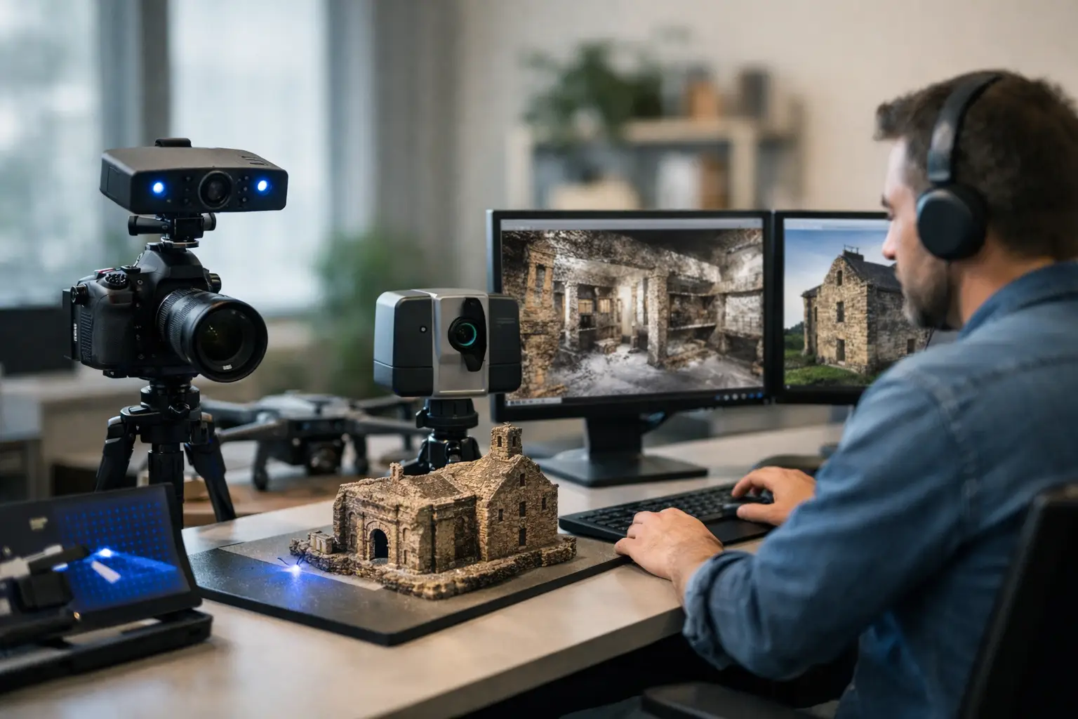
For as-built surveys, this is a major advantage. Existing buildings rarely match old drawings exactly, especially after years of retrofits, undocumented changes, or field adjustments. LiDAR captures those real-world conditions quickly and with enough detail to support design validation, renovation planning, and Scan-to-BIM production.
It is also highly effective for progress verification. Repeated scans over time can show what has been installed, what is misaligned, and where work may be deviating from design intent. For developers, contractors, and consultants, that creates a clearer basis for reporting, coordination, and dispute reduction.
Earthworks and large external sites are another strong fit when airborne or mobile LiDAR is used appropriately. On infrastructure, industrial, and mixed-use developments, broad-area capture can accelerate topographic understanding and improve planning visibility across fast-changing conditions.
Where accuracy can drop
The real answer to is lidar accurate for construction is that it depends on what is being scanned and how. Several conditions can reduce data quality.
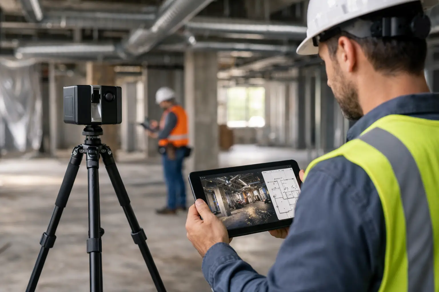
Reflective, transparent, or very dark surfaces can be difficult for LiDAR to read consistently. Glass, polished metal, water, and certain finished materials may produce noisy or incomplete returns. Busy job sites can also introduce obstruction issues. If materials, equipment, or workers block key areas during capture, the resulting dataset may have gaps.
Environmental conditions matter too. Outdoor scanning can be affected by rain, dust, extreme glare, or long-range capture requirements. On larger sites, poor control strategy can create alignment problems between scan positions. Indoors, repetitive spaces such as hotel corridors, office floors, or parking levels can confuse registration if the workflow is not carefully managed.
Then there is the human factor. Inexperienced operators may place too few scan setups, miss critical geometry, use weak control, or deliver point clouds without confirming tolerance requirements. LiDAR is powerful, but it is not self-correcting.
Accuracy by application, not by buzzword
Construction leaders usually get more value when they stop asking whether LiDAR is accurate in general and start asking whether it is accurate enough for a specific deliverable.
For example, if the goal is a digital twin for stakeholder review, remote coordination, or asset visualization, the threshold may be different than for fabrication-level BIM. If the output will support prefabrication, detailed clash mitigation, or structural verification, then survey control, scan density, and QA procedures become more demanding.
This application-first approach is commercially smarter. It prevents over-scanning on simple jobs and under-scanning on critical ones. It also helps avoid the common mistake of treating every project as a generic 3D capture exercise when the real requirement is decision-grade data.
LiDAR versus traditional survey methods
LiDAR does not replace every survey tool, and it should not be framed that way. Traditional total station surveying remains essential for precise control, layout, and targeted dimensional verification. GNSS is still valuable for broader geospatial positioning, especially outdoors. Manual measurement still has a place for quick checks and small isolated tasks.
What LiDAR changes is coverage. It captures the environment at scale, with density and speed that traditional methods cannot match efficiently. That broader data capture reduces the risk of missing something important and gives downstream teams more flexibility. If an architect, engineer, or contractor needs an additional measurement later, the answer may already be in the point cloud instead of requiring another site visit.
From a business standpoint, that can shorten redesign cycles, reduce coordination delays, and improve confidence before costly site work proceeds.
How to make LiDAR accurate on a construction project
Accuracy comes from process discipline. The first step is defining the intended use before scanning begins. Teams should be clear about whether the data is for concept planning, BIM authoring, QA comparison, quantity analysis, or facility management.
Next comes capture planning. Scan positions, control points, line-of-sight limitations, and site activity all affect the result. A rushed site visit often creates expensive problems later, especially on projects with congested services, phased access, or active trades.
Registration and validation are just as important as field capture. Point clouds should be checked against control and reviewed for drift, shadow zones, and incomplete geometry. If the output is going into BIM, the modeling standard and level of detail should be agreed upfront. That keeps expectations aligned between survey teams, designers, contractors, and owners.
This is where an experienced implementation partner adds value beyond simply operating equipment. The difference is not just getting scans. It is getting usable spatial data that supports faster approvals, cleaner coordination, and fewer downstream surprises.
What construction decision-makers should ask before approving LiDAR
The best questions are not about the brand of scanner. They are about outcomes. Ask what tolerance the deliverable needs to meet. Ask how control will be established. Ask whether the site conditions create known capture risks. Ask how the data will be validated, and who will use it afterward.
You should also ask what the final output will look like. A raw point cloud, a registered survey, a BIM-ready dataset, and a fully modeled as-built are not the same product. Each supports different decisions, timelines, and budgets.
For property developers, industrial operators, and project teams managing complex assets across Southeast Asia, this matters because speed alone is not enough. The value comes from turning physical conditions into reliable digital records that people can actually act on.
So, is LiDAR accurate for construction?
Yes, and often extremely so. But the more useful answer is that LiDAR is accurate for construction when the method fits the job, the team defines the tolerance correctly, and the data is handled with survey-grade discipline.
That makes LiDAR less of a gadget and more of a project control tool. When used well, it improves visibility, strengthens coordination, and helps teams make decisions before errors become change orders. If you are investing in spatial capture, aim for data that does more than look impressive on screen. Aim for data your project team can trust when the stakes are real.